
Happy Wednesday everyone! We’re halfway through the week and all eyes are on a hurricane brewing in the Gulf of Mexico. Francine is expected to make landfall later today and will make its way up the Mississippi River, ultimately affecting our weather on Thursday and Friday.
Hurricane Francine is currently approaching the Louisiana coast and is expected to reach land by this evening. As it moves closer, it is merging with a stationary boundary along the Gulf coast, resulting in an extensive expanse of clouds that will gradually move into our area throughout the day.
Take a look at this satellite image that displays the entirety of this phenomenon.
The New Orleans area will experience positive effects as the National Hurricane Center has been gradually shifting the track further east. This weather system will move northward across Mississippi tonight and Thursday, before slightly veering northwest into western Tennessee and western Kentucky.
The National Hurricane Center has provided the most recent information and track forecast.
Take our interactive radar for a spin and witness Francine making landfall in Louisiana today.
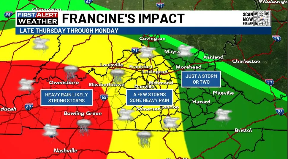
As Francine approaches Kentucky, we are gaining a clearer understanding of its impact on the weather. The initial bands of showers and storms are expected to reach western and southern Kentucky late on Thursday and Thursday evening. These showers and storms will intensify as they rotate counterclockwise around the low-pressure system moving into western Tennessee and western Kentucky on Friday.
Heavy rains and strong storms pose the biggest threat in the western region. Central and parts of eastern Kentucky will experience a few bands of intense storms and heavy rainfall. There will be a distinct cutoff on the northeastern side of this weather system.
